Google launches interactive images appear change the Earth's surface over 28 years
Google has unveiled America today unveiled a new project that allows everyone access to the change in specific parts of the Earth's surface since 1984 to the year 2012, which over 28 years.
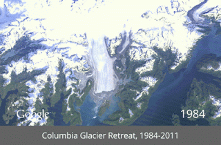
Comes "Timelapse" and is the name that launched the company on the project, the fruit of cooperation between them and the u.s. Geological Survey USGS and NASA space agency and the newspaper "time" this project is a part of its project name is reproduced, which is a compilation of pictures taken over more than a quarter of a century by satellite, and then converted to an interactive map showing the extent of change in some areas by each of the past eight years.
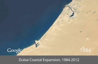
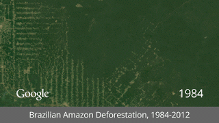
Google said that the draft "Timelapse" built by millions of satellite images and albesklat, all this trillions of universal exploration of the planet, the company struck an example that how through the images found on the stages of change, "Dubai city" and the appearance of architecture and artificial islands along its coastline, in addition to deforestation in the Amazon in Brazil, and others.
It should be noted that Google, other projects have been launched earlier, in December last year to launch a night of world map, world map at night with the concentration of human populations which have lights.

No comments:
Post a Comment